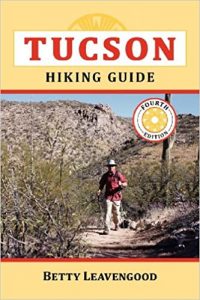
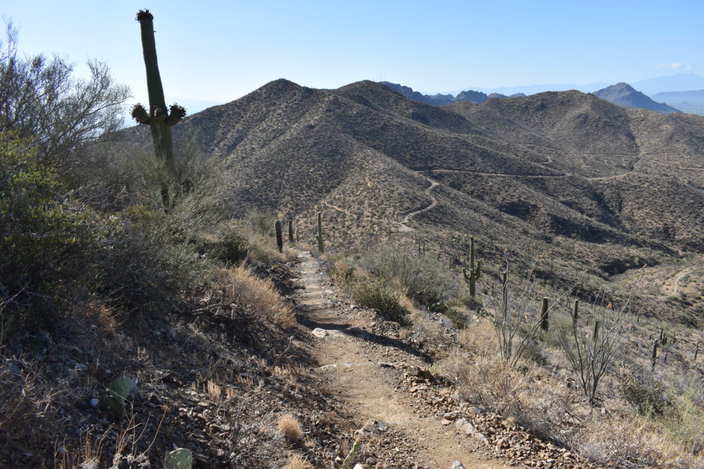
EXPLORE TUCSON HIKING TRAILS
Discover 150+ trails across the Sonoran Desert and the Tucson Mountains—from easy walks to rugged climbs.
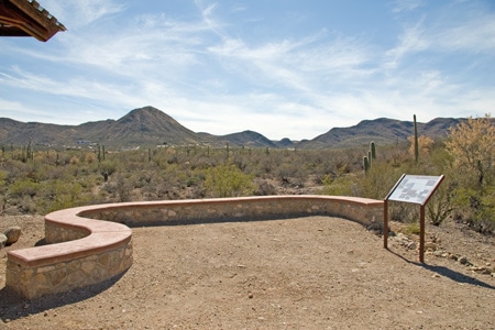
FIND A GREAT HIKING TRAIL
IN THE TUCSON MOUNTAINS
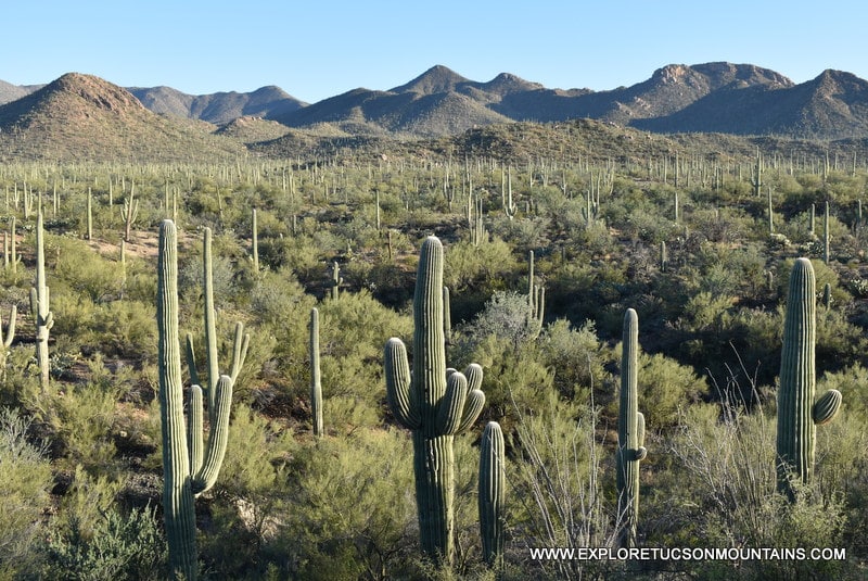
Find your perfect trail to explore the Tucson Mountains, where more than 150 routes wind through iconic Sonoran Desert landscapes. From easy walks to challenging hikes, this guide helps you explore options across Saguaro National Park West, Tucson Mountain Park, and Sweetwater Preserve.
Browse by category—ADA-accessible, dog-friendly, or difficulty level—or explore the full trail list with details on distance, elevation, and features to plan your hike with confidence. Use the trail map and search tools to quickly find routes by name, location, or the experience you’re looking for.
ADA ACCESSIBLE TRAILS
FELIZ PASEO PARK

Feliz Paseos Park is the first park in Arizona, and one of the first in the country, with a focus on universal accessibility.
The park features a handicapped-accessible trail system with interpretive signs. It includes a paved parking area and a plaza with a large ramada with two ADA accessible family restrooms. The park is located on 56 acres of desert near the northeast corner of Gates Pass Road and Camino de Oeste.
- 2 miles of multi-use hiking trails, paved and natural tread trails
- Interpretive signs
- Drinking water & restrooms
- Shade Ramada
- Leashed dogs are permitted
The park is intended for use by everyone, regardless of ability.
Feliz Paseo Park
1600 North Camino de Oeste
Tucson, AZ 85745
520-724-5000
Open daily, 7:00 AM to sunset
https://az-pimacounty.civicplus.pro/1238/Feliz-Paseos-Park
Dogs are permitted on the trails. Restrooms and water are available.
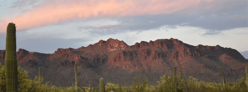
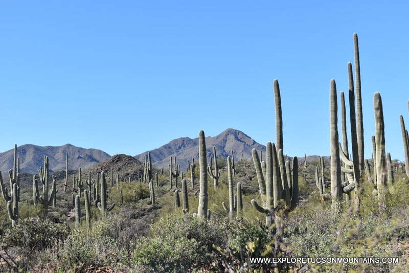
SAGUARO NATIONAL PARK – WEST

The Saguaro National Park – West, with it’s lush Sonoran Desert landscape and volcanic rock formations, is one of the most unusual hiking locations in the country. Trails provide access to a wide variety of desert fauna, unique rock formations, desert wildlife, and much more. The park has two ADA compliant trails:
The Cactus Garden Trail is a short (100 yard) trail located in front of the Red Hills Visitor Center. The paved trail is wheelchair accessible and offers resting benches along the route. Interpretive signs and exhibits acquaint visitors with the common plants found in the Tucson Mountain Range.
The Desert Discovery Trail is a .4 mile loop trail at the foot of the Tucson Mountains. The trailhead is 1 mile northwest of the Red Hills Visitor Center on Kinney Road. A roadside marker indicates the position of the trailhead. The paved trail is wheelchair accessible and offers resting benches and shaded ramadas. Interpretive signs provide details on native plants, animals, and the Sonoran Desert Ecosystem.
Leashed dogs are permitted on these two trails but are not allowed on other hiking trails in the park.
Water bottle filling stations and ADA Compliant restrooms are available at the visitor center. Also available are maps, a gift and bookstore, support staff, and monthly programs. For more information on monthly education programs and guided tours, visit the park’s Calendar Webpage.
Saguaro National Park-West has over 60 miles of Tucson hiking trails.
Red Hills Visitor Center
Saguaro National Park – West
2700 N Kinney Rd
Tucson AZ 85743
520-733-5158
The park is open daily, sunrise to sunset.
The visitor center is open daily from 9:00 AM – 5:00PM.
Leashed dogs are permitted on The Cactus Garden Trail and The Desert Discovery Trail only.
Restrooms and water are available at the Red Hills Visitor Center.
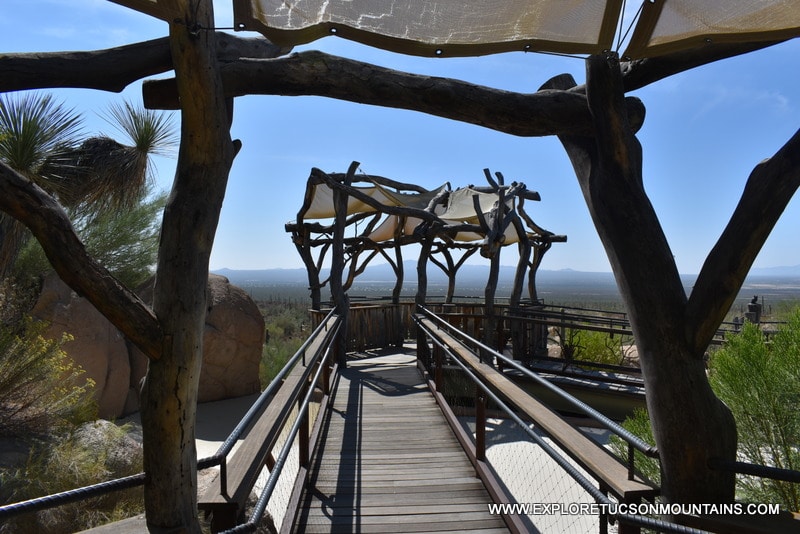
ARIZONA SONORA DESERT MUSEUM
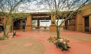
The Arizona-Sonora Desert Museum combines a zoo, aquarium, botanical garden, natural history museum, publisher, and art gallery . . . all in a single location. Plus, 85% of the attractions are outdoors. Two miles of walking paths connect natural displays of plants and animals native to the Sonoran Desert. Approximately half of the paths are paved and half unpaved with compacted materials. Some sections are moderately hilly.
96 percent of the exhibits can be reached by wheelchair, allowing most to see the flora and fauna of the Sonoran Desert in safety and comfort. The Museum maintains a small fleet of manual wheelchairs, child strollers, and a limited number of electric convenience vehicles (ECVs), which are available for rent at the front ticket window on a first-come, first-serve basis.
All buildings and the majority of the restroom facilities are wheelchair accessible, with ramps located wherever there are stairs.
AZ – Sonora Desert Museum
2021 N. Kinney Rd.
Tucson, AZ 85743
520-883-2702
Open daily year round. Hours vary by season, Visit website or call before you plan your visit.
Dogs are not permitted in the museum. Restrooms and water are available.
SWEETWATER WETLANDS
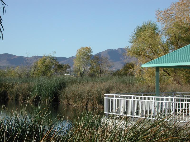

The Sweetwater Wetlands uses reclaimed water and serves as an environmental education facility and habitat for a wide variety of wildlife. It has more than 2.5 miles of hiking trails accessible to visitors. Almost 1,000 feet of the pathway is surfaced with concrete and ADA-approved for wheelchair access. Concrete surfacing allows easy access from the parking area to the main ramada. Pathways are generally flat and surfaced by either decomposed granite or ¾-inch gravel. Some areas may be thicker than others.
- Bicycle riding, dogs, and horses are not permitted.
- The drinking fountain includes a water bottle filling station.
- A hand-wash station makes it convenient to wash up.
- ADA compliant bathrooms are at the trailhead.
The site is a hot spot for birding. Weekly Birding Trips offered by the Tucson Audubon Society occur every Wednesday morning. The trips last 2 hours, and the start time varies by season.
Sweetwater Wetlands
2511 W Sweetwater Dr
Tucson, AZ 85745
520-791-4331
Open Tues – Sun, sunrise to sunset. Open Mondays at 9:00 AM.
www.tucsonaz.gov/water/sweetwater-wetlands
Sweetwater Wetlands
eBird CHECKLIST
Dogs are not permitted on trails. Restrooms and water are available.
DESTINATION TRAILS
BOWEN STONE HOUSE
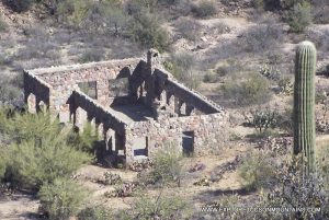
The Bowen Stone House was built by Sherry and Ruby Bowen in the early 1930s. They moved to Tucson and homesteaded the property, thinking the climate would be suitable for Ruby’s health. Sherry Bowen was a typesetter and later an editor of the Arizona Daily Star. Ruby wrote for the Desert Magazine of the Southwest and a book, “Arizona Homestead: An Adventure in Beauty.” about her experiences in the cabin. They homesteaded 2,000 acres. They had a child born in the home in 1943 and eventually moved back east in 1944. The house was incorporated into the Tucson Mountain Park in 1983.
There are two popular hiking trails to get to the Bowen Stone House.
Yetman Trail – Camino De Oeste Trailhead (1.2 miles one way)
The trailhead is at the end of Camino de Oeste. Parking is available. The Yetman Trail follows a wash and intersects with the Bowen Trail after .7 of a mile. Stay right on the Yetman Trail, which will lead directly to the stone house in .5 miles.
Bowen Trail (1.3 one way}
Start from the Bowen Trailhead off W Starr Pass Blvd at the JW Marriott Star Pass Resort. The trail intersects the Yetman Trail after .8 miles. Turn left onto the Yetman Trail, and the Stone House is .5 miles up the trail.
The house walls and fireplace were built from local rock. The home had numerous large windows, two fireplaces, and a bathtub. The floors were concrete, the walls were once paneled with redwood siding, and it had a tin roof. Water was provided by a windmill, well, and a small pond. Only the walls stand today. A fire consumed the roof and interior in 1970.
Bowen Stone House
Tucson Mountain Park
Suggested Routes
Yetman Trail – Bowen Stone House
Camino De Oeste Trailhead
415 N Camino de Oeste
Tucson, AZ 85745
2.4 Miles — Round Trip
Easy
Elevation: 2,694 – 2,832
Trail Map
Bowen Trail – Bowen Stone House
3768 West Starr Pass Boulevard
Tucson AZ, 85745
2.6 Miles — Round Trip
Easy/Intermediate
Elevation: 2,751 – 2,832
Trail Map
Open daily: sunrise to sunset.
Dogs are not permitted on the trails. Restrooms and water are not available.
GOULD MINE
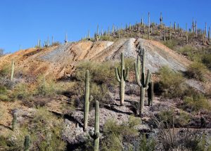
The Gould Mine was established in 1906 by S.H. Gould, who sensationalized that the mine contained a mother lode of copper. It did produce 45,000 pounds of copper valued at $9,000 at that time but after several years the company went bankrupt and ceased operations in 1911. It is currently classed as an archaeological site by the National Register.
Start from the King Canyon Trailhead, which is directly across Kinney Road from the Arizona-Sonora Desert Museum. From the parking lot, drop into and cross the wash. A path leads up the wash’s north bank to a sign marking the Gould Mine Trail. Follow the trail up a gradual slope For 1.1 miles directly to the Gould Mine and the Sendero Esperanza Trail. 2.4 miles round trip.
The 300+ feet deep pit is covered by an iron grate, and the powder house walls still stand. Foundations for the blacksmith shop and mess hall also remain. Samples of azurite, epidote, garnet, malachite, and pyrite, possibly originating from the mine tailings, can be found along the Sendero Esperanza Trail. The mine tailings can be seen from Kinney Rd north of the AZ-Sonoran Desert Museum.
An alternative return route can be created by taking the Sendero Esperanza Trail to Kings Canyon Trail. Ancient petroglyphs can be seen in the wash near the Mah-A-Gah Picnic Area.
Gould Mine
Saguaro National Park – West
Tucson Mountains
Gould Mine Trail – Gould Mine
2.4 Miles – Round Trip
Easy
Elevation: 2,881 – 3,154
Trail Map
Open daily: sunrise to sunset.
Dogs are not permitted on the trails. Restrooms and water are not available.
SIGNAL HILL PETROGLYPHS
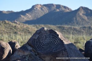
Signal Hill petroglyphs site is located in the Saguaro National Park-West. There are dozens of images viewable from a short trail and viewing area. Look at the images up to the left as you start to climb the trail, they are commonly missed.
A large spiral image, a favorite among photographers, is at the viewing area on top of the hill. The panoramic view of Wasson Peak and Sombrero Peak over an incredibly dense Saguaro forest is incredible.
Directions from the park’s Red Hills Visitor Center: Turn right onto Kinney Rd. Go 1.8 miles onto N. Sandario Rd. Go .3 miles and turn right onto Golden Gate Rd. Go 1.5 miles and turn left onto Signal Hill Rd. The Signal Hill Trailhead is at the picnic area. The hike to the petroglyphs is only .4 mile roundtrip.
Climbing on the rocks is not permitted. Please stay on the trail and viewing area. Please note . . . Golden Gate Road is closed at sunset.
Signal Hills Petroglyphs
Saguaro National Park – West
Tucson Mountains
Signal Hill Trail – Petroglyphs
.4 Mile — Round Trip
Easy
Elevation: 2,442 – 2,461
TRAIL MAP
Open daily: sunrise to sunset.
Dogs are not permitted.
Water is not available.
Restrooms are available.
Tumamoc Hill
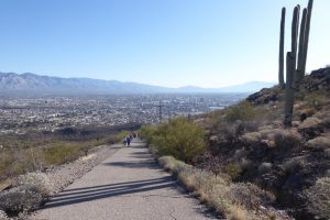
Tumamoc Hill Trail (1.5 miles – one way)
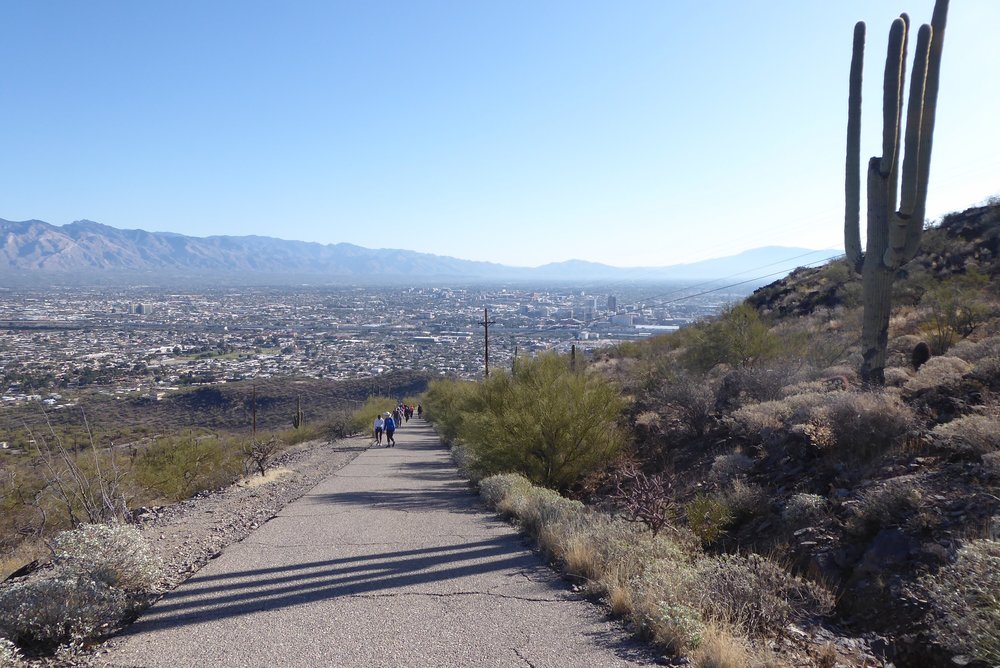
The trailhead is off of Anklam Rd across the street from St. Mary’s Hospital. The trail is one of the most popular in the city, averaging more than 7,000 hikers per week. It is not a hike to find solitude but an excellent urban hike to embrace the community. It presents a heart-pounding cardiovascular workout with a 700-foot climb over 1.5 miles to a vista with panoramic views of the city of Tucson.
The beginning of the hike climbs a gentle slope, but as you reach the midway point, you will hit a series of switchbacks with steep inclines. Also near the midway point are research buildings (please do not disturb) and two port-a-potties. The view from the top is a favorite for those wanting to watch a sunrise, sunset, or view of downtown Tucson.
Tumamoc Hill is not a park. It is an ecological reserve and cultural site with ongoing scientific research on plants and animals. Tumamoc Hill is listed in the National Register of Historic Places and is also a National Historic Landmark. It is home to the UA Science Tumamoc Desert Laboratory, founded in 1903 and the world’s longest continuously monitored vegetation plots.
Parking can be difficult. There is limited parking available on Anklam, but no parking is permitted at St Mary’s. Please stay on paved paths and leave your dogs at home.
Tumamoc Hill
Tumamoc Hill Rd and Anklam Rd
Tucson, AZ 85745
Tumamoc Hill Trail
3.0 Miles — Round Trip
Intermediate / Difficult
Elevation: 2367 / 3107
TRAIL MAP
Open daily: 4:00 AM – 10:00 PM.
Dogs are not permitted on the trails. Port-a-Pots are located at the halfway point. Water is not available.
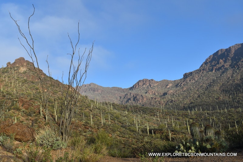
WASSON PEAK
Wasson Peak is the highest peak (4,687 feet) in the Tucson Mountains and offers stunning panoramic views. There are 3 popular routes to the summit.
Via King Canyon Trail (3.55 miles, one way)
The trailhead and parking area are directly across Kinney Road from the Arizona-Sonora Desert Museum. The first .9 miles is a gradual climb up to Mah-A-Gah Picnic Area. Stop and look for the Petroglyphs located in the wash before you get to the picnic area. Follow the marked trail 1.4 miles to the junction of the Sweetwater Trail. The trail climbs a series of switchbacks for the next .9 miles up to the Hugh Norris Trail. The final .3 miles ascends the Hugh Norris Trail to the top of Wasson Peak. An alternative return route can be created by taking the Hugh Norris Trail down to the Sendero Esperanza Trail, which leads back to the King Canyon Trail.
Via Hugh Norris Trail (4.9 miles, one way)
The trailhead is located off the Bajada Loop Drive, 2.5 miles north of the Red Hills Visitor Center. The trail starts with a series of switchbacks that climb to a ridge overlooking the Saguaro forest. The trail continues along the ridge – top through areas with impressive views and large rock formations. At 4.1 miles, it reaches Amole Peak, the second-highest point in the mountains at 4,482 feet. The last .8 miles go up a final series of switchbacks and a gradual climb that leads to the top of Wasson Peak.
Via Sweetwater Trail (4.7 miles, one way)
The trailhead is located at the western end of El Camino del Cerro Road. The trail climbs 3.4 miles to a ridge where it ends at the King Canyon Trail. Continue up the King Canyon Trail .9 miles to the Hugh Norris Trail, then .3 miles to Wasson Peak.
Wasson Peak
Saguaro National Park – West
Tucson Mountain Range
Elevation: 4,687 Feet
Suggested Summit Trails:
King Canyon Trail
7.1 miles — Round Trip
Intermediate/Difficult
Elevation: 2.914 / 4,687
TRAIL MAP
Hugh Norris Trail
9.8 miles — Round Trip
Intermediate/Difficult
Elevation: 2,574 / 4,687
TRAIL MAP
Sweetwater Trail
9.4 miles — Round Trip
Intermediate
Elevation: 2,814 / 4687
TRAIL MAP
Open daily: sunrise to sunset.
Dogs are not permitted on the trails. Restrooms and water are not available.
DOG FRIENDLY PARKS & TRAILS
FELIZ PASEO PARK
Feliz Paseos Park is the first park in Arizona, and one of the first in the country, with a focus on universal accessibility. Dogs on leash are allowed.
The park features a handicapped-accessible trail system with interpretive signs. It includes a paved parking area and a plaza with a large ramada with two ADA accessible family restrooms. The park is located on 56 acres of desert near the northeast corner of Gates Pass Road and Camino de Oeste.
- 2 miles of multi-use paths, paved and natural tread trails
- Interpretive signs
- Drinking water & restrooms
- Shade Ramada
- Leashed dogs are permitted
The park is intended for use by everyone, regardless of ability.
Feliz Paseo Park
1600 North Camino de Oeste
Tucson, AZ 85745
520-724-5000
https://az-pimacounty.civicplus.pro/1238/Feliz-Paseos-Park
Open daily, 7:00 AM to sunset
Open daily: sunrise to sunset.
Dogs are permitted on the trails. Restrooms and water are available.
SWEETWATER PRESERVE
The Sweetwater Preserve is an 880+ acre preserve located in the eastern foothills of the Tucson Mountains. It was designed to protect the habitat of the Sonora desert wildlife while providing a wide range of activities to the community, including recreational trails for hikers, equestrians, mountain bikers, trail runners, and other users of non-motorized trails. Leashed dogs are permitted in the park.
The park features 16 short trails and nearly 15 miles through large stands of palo verde trees and Saguaro cacti. The trails can be combined to create longer loop trails.
- Popular trails include the Desperado Loop Trail, Black Rock Loop Trail, and Saguaro Vista Trail.
- The trailhead is located at the southern end of Tortolita Road and has parking for 24 vehicles and 8 horse rigs.
- The Preserve is approximately 1/2 mile from Saguaro National Park – West.
- Coyotes, javelina, mule deer, and other desert wildlife are common in the Preserve.
- Sweetwater Preserve has 13 miles of Tucson hiking trails. These trails can be connected to create various loops.
Sweetwater Preserve
4001 N. Tortolita Road
Tucson, AZ 85745
520-724-5000
https://webcms.pima.gov/cms/one.aspx?portalId=169&pageId=1531
Open daily, 7:00 AM to sunset
Open daily: sunrise to sunset.
Dogs are permitted on the trails. Restrooms and water are not available.
ROBLES PASS AT TUCSON MOUNTAIN PARK
The Robles Pass Trails Park is nearly 1,000 acres in size and is part of the Tucson Mountain Park. It was designed to provide trails in a natural setting near urban areas close to where people live and work. The park is open to hikers, equestrians, mountain bikers, trail runners, hand bicycles, and other users of non-motorized trails. Leashed dogs are permitted on the trails.
The park features 13 short trails and nearly 15 miles through large stands of mesquite and palo verde trees and creosote bushes. The trails can be combined to create longer loop trails.
Parking is limited and can be found:
- At the end of Lincoln Street, turn off Ajo Highway at Bilbray Avenue.
- Off of Irvington Road, east of Soledad Avenue.
- Off of Irvington Road, east of Cactus Wren Avenue.
Robles Pass at Tucson Mtn Park
Between W. Ajo Hwy & W. Irvington Rd.
520-724-5000
https://webcms.pima.gov/cms/one.aspx?portalId=169&pageId=1519
Open daily, 7:00 AM to sunset
Open daily: sunrise to sunset.
Dogs are permitted on the trails. Restrooms and water are not available.
INTERPRETIVE TRAILS
FELIZ PASEO PARK
Feliz Paseos Park is the first park in Arizona, and one of the first in the country, with a focus on universal accessibility.
The park features a handicapped-accessible trail system with interpretive signs. It includes a paved parking area and a plaza with a large ramada with two ADA accessible family restrooms. The park is located on 56 acres of desert near the northeast corner of Gates Pass Road and Camino de Oeste.
- 2 miles of multi-use paths, paved and natural tread trails
- Interpretive signs
- Drinking water & restrooms
- Shade Ramada
- Leashed dogs are permitted
The park is intended for use by everyone, regardless of ability.
Feliz Paseo Park
1600 North Camino de Oeste
Tucson, AZ 85745
520-724-5000
https://az-pimacounty.civicplus.pro/1238/Feliz-Paseos-Park
Open daily, 7:00 AM to sunset
Open daily: sunrise to sunset.
Dogs are permitted on the trails. Restrooms and water are available.
SAGUARO NATIONAL PARK WEST

The Saguaro National Park – West, with it’s lush Sonora Desert landscape and volcanic rock formations, is one of the most unusual hiking locations in the country. Trails provide access to a wide variety of desert fauna, unique rock formations, desert wildlife, and much more. The park has three interpretive trails:
The Javelina Wash Trail is a .2 mile loop trail that winds around the Red Hills Visitor Center. The trail starts on the right side of the visitor center and works its way into a sandy wash with abundant Saguaros, Cholla, Ocotillo, and Ironwood trees. It ends back into the center parking lot. Interpretive signs help introduce hikers to the plants and cactus of the Sonoran Desert. The entire trail is not wheelchair accessible.
The Cactus Garden Trail is a short (100 yard) trail located in front of the Red Hills Visitor Center. The paved trail is wheelchair accessible and offers resting benches along the route. Interpretive signs and exhibits acquaint visitors with the common plants found in the Tucson Mountain Range.
The Desert Discovery Trail is a .4 mile loop trail at the foot of the Tucson Mountains. The trailhead is 1 mile northwest of the Red Hills Visitor Center on Kinney Road. A roadside marker indicates the position of the trailhead. The paved trail is wheelchair accessible and offers resting benches and shaded ramadas. Interpretive signs provide details on native plants, animals, and the Sonoran Desert Ecosystem.
Leashed dogs are permitted on The Cactus Garden Trail and The Desert Discovery Trail but are not allowed on other trails in the park.
Water bottle filling stations and ADA Compliant restrooms are available at the visitor center. Also available are maps, a gift and bookstore, support staff, and monthly programs. For more information on monthly education programs and guided tours, visit the park’s Calendar Webpage.
Saguaro National Park-West has over 60 miles of Tucson hiking trails.
Red Hills Visitor Center
Saguaro National Park – West
2700 N Kinney Rd
Tucson AZ 85743
520-733-5158
The park is open daily, sunrise to sunset.
The visitor center is open daily from 9:00 AM – 5:00PM.
Open daily: sunrise to sunset.
Leashed dogs are permitted on The Cactus Garden Trail and The Desert Discovery Trail only.
Restrooms and water are available at the Red Hills Visitor Center.
ARIZONA SONORA DESERT MUSEUM
The Arizona-Sonora Desert Museum combines a zoo, aquarium, botanical garden, natural history museum, publisher, and art gallery . . . all in a single location. Plus, 85% of the attractions are outdoors. Two miles of walking paths connect natural displays of plants and animals native to the Sonoran Desert. Approximately half of the paths are paved and half unpaved with compacted materials. Some sections are moderately hilly.
96 percent of the exhibits can be reached by wheelchair, allowing most to see flora and fauna of the Sonoran Desert in safety and comfort. The Museum maintains a small fleet of manual wheelchairs, child strollers, and a limited number of electric convenience vehicles (ECVs), which are available for rent at the front ticket window on a first-come, first-serve basis.
All buildings and the majority of the restroom facilities are wheelchair accessible, with ramps located wherever there are stairs.
AZ – Sonora Desert Museum
2021 N. Kinney Rd.
Tucson, AZ 85743
520-883-2702
Open daily year round. Hours vary by season, Visit website or call before you plan your visit.
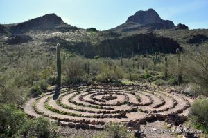
SANCTUARY COVE
Sanctuary Cove is a non-profit 80-acre nature preserve that provides a place of quiet prayer, meditation, and self-reflection in a beautiful southwest desert setting. It was founded by Elmer Staggs, a WWI vet., who came to Arizona for his health in 1917 and homesteaded most of the Safford Peak area.
In 1957 Mr. Staggs founded the All Creeds Brotherhood, which has led efforts to protect the wilderness around Sanctuary Cove at the base of Safford Peak.
Sanctuary Cove Loop is a meditative desert trail located within the sanctuary that offers the chance to see desert fauna and wildlife and is appropriate for all skill levels. The hike passes a quaint brick chapel and many inspirational signs to motivate you as you hike through a picturesque desert landscape. Also, along the trail is an inspirational rock labyrinth designed to increase your meditative state of mine.
The sanctuary requests a donation at the parking lot. The trail is for hiking only. No horses, mountain bikes, or dogs are allowed.
Sanctuary Cove
8001 N Scenic Dr
Tucson, Arizona 85743
(520) 744-2375
Sanctuary Cove Loop
1.0 mile – Loop
Easy
Elevation: 2,280 – 2,460
TRAIL MAP
Open daily from dawn to dusk.
No admission fee. Donations are appreciated.
Dogs are not permitted on the trails. Restrooms and water are not available.
MOST POPULAR TRAILS
SAGUARO NATIONAL PARK — WEST

The Saguaro National Park – West, with it’s lush Sonora Desert landscape and volcanic rock formations, is one of the most unusual hiking locations in the country. Over 40 trails criss-cross the mountains providing access to a wide variety of desert fauna, unique rock formations, desert wildlife, and much more. Listed below are some of the more popular trails hiked within the park.
Hugh Norris Trail (4.90 mile – one way)
This is the longest trail in the Tucson Mountain District. It begins off the Bajada Loop Drive, 2.5 miles north of the Red Hills Visitor Center. The trail was named after a former Chief of the Tohono O’odham Indian Police. The trail begins with a series of switchbacks that climb to a ridge overlooking the cactus forest. From there, the trail follows the ridge – top through areas with splendid views and unique rock formations until it reaches Amole Peak, approximately 4.1 miles from the trailhead. The next .8 miles go up a final series of switchbacks and a gradual climb that leads to the top of Wasson Peak.
King Canyon Trail (3.50 mile – one way)
The trailhead and parking area for this hike are directly across Kinney Road from the Arizona-Sonora Desert Museum, two miles east of the Red Hills Visitor Center. The first .9 miles is a gradual climb up to Mam-AGah Picnic Area, which was named after a Tohono O’odham Indian Chief. The next 1.4 miles to the junction of the Sweetwater Trail are steeper. Numerous switchbacks on the next .9 miles lead to the Hugh Norris Trail. The final .3 miles ascends the Hugh Norris Trail to the top of Wasson Peak (elevation 4,687 feet), the highest point in the Tucson Mountains.
Sweetwater Trail (3.40 mile – one way)
The Sweetwater Trail is the only access to Wasson Peak from the eastern side of the Tucson Mountains. The trailhead is located at the western end of El Camino del Cerro Road. The trail climbs 3.4 miles to a ridge where it ends at the King Canyon Trail. To reach Wasson Peak, continue up the King Canyon Trail .9 miles to the Hugh Norris Trail, then .3 miles to Wasson Peak.
Saguaro National Park-West has over 60 miles of Tucson hiking trails.
Saguaro National Park – West
Tucson Mountain Range
Suggested Trails:
Hugh Norris Trail
9.80 mile – Round Trip
Intermediate/Difficult
Elevation: 2,574 / 4,687
TRAIL MAP
King Canyon Trail
7.0 mile – Round Trip
Intermediate/Difficult
Elevation: 2.914 / 4,687
TRAIL MAP
Sweetwater Trail
6.8 mile – Round Trip
Intermediate
Elevation: 2,814 / 4687
TRAIL MAP
Open daily: sunrise to sunset.
Dogs are not permitted on the trails. Restrooms and water are not available.
TUCSON MOUNTAIN PARK
Tucson Mountain Park was once the largest county park in America. For nearly 100 years, hikers from all over the world have enjoyed the 70+ trails that wind through the unique Sonoran landscape. This area is so spectacular it has been the backdrop for over 400 movies and TV shows. Listed below are some of the more popular trails within the park.
Brown Mountain Trail (4.55 mile – loop)
The trailhead and a small parking area are at the M9 pullout on McCain Loop south of Kinney Rd and just before the turnoff for Gilbert Ray Campground. It is suggested to hike the loop in a counter-clockwise route. There are 4 distinct uphill stretches, with the first being the most difficult. The loop circles the crest of Brown Mountain and returns to the original trailhead. The trail can be rocky at times, and there are plenty of cactus near the trail. Views of the Saguaro National park and Arizona Sonora Desert Museum are available from several vistas. Brown Mountain Trail is very popular for sunset watchers.
Hidden Canyon Trail (2.52 mile – loop)
The trailhead and parking area are at 3800 W Starr Pass Blvd across the street from the main entrance to Starr Pass Resort. From the trailhead, the trail rises upward to excellent vistas providing picturesque overviews of the Saguaro forest covering the desert mountains. The loop trail is ideal for those looking for a shorter trail that offers outstanding views. Although close to a popular resort, the trail is lightly used and known for providing peace and solitude.
Starr Pass Trail (4.80 mile – one way)
The trailhead (Richard Genser Trailhead) and a large parking area are located at the end of Clearwell Rd. which runs off of Starr Pass Blvd near the golf course. After just over .3 mile, the trail intersects with Rock Wren Trail. Keep left to stay on Starr Pass Trail. Past the halfway point, the trail sweeps right and for a short time will be a dirt road before joining with the Yetman Trail. An alternative return route (8.6-mile loop) is to take Yetman Trail to Rock Wren Trail back to the Richard Genser Trailhead. The trail offers a variety of terrains and views of Tucson and Mount Lemmon. It is a popular hike to catch sunrises and sunsets.
Yetman Trail (6.25 mile — one way)
Yetman Trail has trailheads and parking available at both the start and finish. Hikers can pick either location to do an out and back route (12.5-miles) or leave a car at the second trailhead to shuttle to the start. On the eastern side of the mountain, the trail starts at the Camino de Oeste Trailhead, located at the end of Camino de Oeste Rd. The second trailhead is just over Gates Pass on the western side at Gates Pass G3 pullout. The trail is unique because it travels between Starr Pass and Gates Pass over a saddle between Golden Gate Mountain and Bren Peak. It also passes a crested Saguaro, the Yetman Trail Viewpoint, and the Bowen Stone House. Gates Pass G3 pullout is a popular spot to watch an Arizona sunset.
Tucson Mountain Park has over 62 miles of Tucson hiking trails.
Tucson Mountain Park
Tucson Mountain Range
Suggested Summit Trails:
Brown Mountain Trail
4.55 Mile – Loop
Intermediate/Difficult
Elevation: 2,660 / 3,071
TRAIL MAP
Hidden Canyon Trail
1.52 Mile – Loop
Intermediate
Elevation: 2,737 / 3,087
TRAIL MAP
Starr Pass Trail
9.60 Mile – Round Trip
Intermediate
Elevation: 2,676 / 2,878
TRAIL MAP
YetmanTrail
13.5 Mile — Round Trip
Intermediate
Elevation: 2,689 / 3,145
TRAIL MAP
Open daily: sunrise to sunset.
Dogs are not permitted on the trails. Restrooms and water are not available.
SWEETWATER PRESERVE

The Sweetwater Preserve is an 880+ acre preserve located in the eastern foothills of the Tucson Mountains. It was designed to protect the habitat of the Sonora desert wildlife while providing a wide range of activities to the community, including recreational trails for hikers, equestrians, mountain bikers, trail runners, and other users of non-motorized trails. Leashed dogs are permitted in the park.
The park features 16 short trails and nearly 15 miles through large stands of palo verde trees and Saguaro cacti. The trails can be combined to create longer loop trails. Listed below are some of the more popular trails within the park.
Desperado Loop Trail (3.6 miles –loop)
The trailhead and large parking area are located at the end of N. Tortalita Rd. Desperado Loop Trail is one of the least rocky trails in the Preserve. It starts with a gentle climb and rises to a ridge system with views of the Santa Cruz valley. The trail travels through heavy clusters of Saguaros and multiple shallow arroyos before returning to the trailhead.
Saguaro Vista Trail to Black Rock Loop Trail (3.8 miles — loop)
The trailhead and large parking area are located at the end of N. Tortalita Rd. The loop starts on the Saguaro Crest Trail within a dense forest of large Saguaro cacti. Shortly down the trail, on the left, is a rare Crested Saguaro. Only 1 in 10,000 Saguaros are crested. After 1.1 miles, the trail intersects with the Black Rock Loop Trail. This trail is 1.6 miles long and winds back to the Saguaro Vista Trail. This hike is popular because of the large Saguaros and rolling desert terrain. There are many excellent spots for photographers to capture Saguaros and desert landscapes.
The trailhead has parking for 24 vehicles and 8 horse rigs. The Preserve is approximately 1/2 mile from Saguaro National Park – West.
Saguaro National Park-West has over 60 miles of Tucson hiking trails.
Sweetwater Preserve
4001 N. Tortolita Road
Tucson, AZ 85745
520-724-5000
https://webcms.pima.gov/cms/one.aspx?portalId=169&pageId=1531
Desperado Loop Trail
3.6 Mile — Loop
Easy/Intermediate
Elevation: 2,402 – 2,564
TRAIL MAP
Saguaro Vista Trail to Black Rock Loop Trail
3.8 Mile Loop
Easy/Intermediate
Elevation: 2,468 – 2587
TRAIL MAP
Open daily, 7:00 AM to sunset
Open daily: sunrise to sunset.
Dogs are permitted on the trails. Restrooms and water are not available.
TUMAMOC HILL
Tumamoc Hill Trail The trailhead is off of Anklam Rd across the street from St. Mary’s Hospital. The trail is one of the most popular in the city, averaging more than 7,000 hikers per week. It is not a hike to find solitude but an excellent urban hike to embrace the community. It presents a heart-pounding cardiovascular workout with a 700-foot climb over 1.5 miles to a vista with panoramic views of the city of Tucson.
The beginning of the hike climbs a gentle slope, but as you reach the midway point, you will hit a series of switchbacks with steep inclines. Also near the midway point are research buildings (please do not disturb) and two port-a-potties. The view from the top is a favorite for those wanting to watch a sunrise, sunset, or view of downtown Tucson.
Tumamoc Hill is not a park. It is an ecological reserve and cultural site with ongoing scientific research on plants and animals. Tumamoc Hill is listed in the National Register of Historic Places and is also a National Historic Landmark. It is home to the UA Science Tumamoc Desert Laboratory, founded in 1903 and the world’s longest continuously monitored vegetation plots.
Parking can be difficult. There is limited parking available on Anklam, but no parking is permitted at St Mary’s. Please stay on paved paths and leave your dogs at home.
Tumamoc Hill
Tumamoc Hill Rd and Anklam Rd
Tucson, AZ 85745
Tumamoc Hill Trail
3.0 Mile – Round Trip
Intermediate / Difficult
Elevation: 2367 / 3107
TRAIL MAP
Open daily: 4:00 AM – 10:00 PM.
Dogs are not permitted on the trails. Port-a-Pots are located at the halfway point. Water is not available.
BEST WILDFLOWER TRAILS
BROWN MOUNTAIN TRAIL
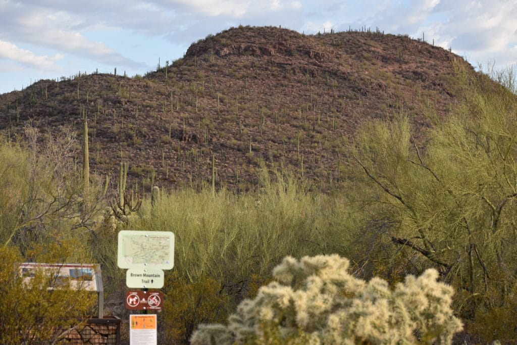
Brown Mountain Trail (4.55 mile – loop)
The trailhead and a small parking area are at the M9 pullout on McCain Loop south of Kinney Rd and just before the turnoff for Gilbert Ray Campground. It is suggested to hike the loop in a counter-clockwise route. There are 4 distinct uphill stretches, with the first being the most difficult. The loop circles the crest of Brown Mountain and returns to the original trailhead. The trail can be rocky at times, and there are plenty of cactus near the trail. Views of the Saguaro National park and Arizona Sonora Desert Museum are available from several vistas. Brown Mountain Trail is very popular for sunset watchers.
GOULD MINE
The Gould Mine was established in 1906 by S.H. Gould, who sensationalized that the mine contained a mother lode of copper. It did produce 45,000 pounds of copper valued at $9,000 at that time but after several years the company went bankrupt and ceased operations in 1911. It is currently classed as an archaeological site by the National Register.
Start from the King Canyon Trailhead, which is directly across Kinney Road from the Arizona-Sonora Desert Museum. From the parking lot, drop into and cross the wash. A path leads up the wash’s north bank to a sign marking the Gould Mine Trail. Follow the trail up a gradual slope For 1.1 miles directly to the Gould Mine and the Sendero Esperanza Trail. 2.4 miles round trip.
The 300+ feet deep pit is covered by an iron grate, and the powder house walls still stand. Foundations for the blacksmith shop and mess hall also remain. Samples of azurite, epidote, garnet, malachite, and pyrite, possibly originating from the mine tailings, can be found along the Sendero Esperanza Trail. The mine tailings can be seen from Kinney Rd north of the AZ-Sonoran Desert Museum.
An alternative return route can be created by taking the Sendero Esperanza Trail to Kings Canyon Trail. Ancient petroglyphs can be seen in the wash near the Mah-A-Gah Picnic Area.
Gould Mine
Saguaro National Park – West
Tucson Mountains
Gould Mine Trail – Gould Mine
2.4 Miles – Round Trip
Easy
Elevation: 2,881 – 3,154
Trail Map
Open daily: sunrise to sunset.
Dogs are not permitted on the trails. Restrooms and water are not available.
WASSON PEAK
Wasson Peak is the highest peak (4,687 feet) in the Tucson Mountains and offers stunning panoramic views. There are 3 popular routes to the summit.
Via King Canyon Trail (3.55 miles, one way)
The trailhead and parking area are directly across Kinney Road from the Arizona-Sonora Desert Museum. The first .9 miles is a gradual climb up to Mah-A-Gah Picnic Area. Stop and look for the Petroglyphs located in the wash before you get to the picnic area. Follow the marked trail 1.4 miles to the junction of the Sweetwater Trail. The trail climbs a series of switchbacks for the next .9 miles up to the Hugh Norris Trail. The final .3 miles ascends the Hugh Norris Trail to the top of Wasson Peak. An alternative return route can be created by taking the Hugh Norris Trail down to the Sendero Esperanza Trail, which leads back to the King Canyon Trail.
Via Hugh Norris Trail (4.9 miles, one way)
The trailhead is located off the Bajada Loop Drive, 2.5 miles north of the Red Hills Visitor Center. The trail starts with a series of switchbacks that climb to a ridge overlooking the Saguaro forest. The trail continues along the ridge – top through areas with impressive views and large rock formations. At 4.1 miles, it reaches Amole Peak, the second-highest point in the mountains at 4,482 feet. The last .8 miles go up a final series of switchbacks and a gradual climb that leads to the top of Wasson Peak.
Via Sweetwater Trail (4.7 miles, one way)
The trailhead is located at the western end of El Camino del Cerro Road. The trail climbs 3.4 miles to a ridge where it ends at the King Canyon Trail. Continue up the King Canyon Trail .9 miles to the Hugh Norris Trail, then .3 miles to Wasson Peak.
Wasson Peak
Saguaro National Park – West
Tucson Mountain Range
Elevation: 4,687 Feet
Suggested Summit Trails:
King Canyon Trail
7.1 miles — Round Trip
Intermediate/Difficult
Elevation: 2.914 / 4,687
TRAIL MAP
Hugh Norris Trail
9.8 miles — Round Trip
Intermediate/Difficult
Elevation: 2,574 / 4,687
TRAIL MAP
Sweetwater Trail
9.4 miles — Round Trip
Intermediate
Elevation: 2,814 / 4687
TRAIL MAP
Open daily: sunrise to sunset.
Dogs are not permitted on the trails. Restrooms and water are not available.
TUCSON MOUNTAINS TRAILS MAP
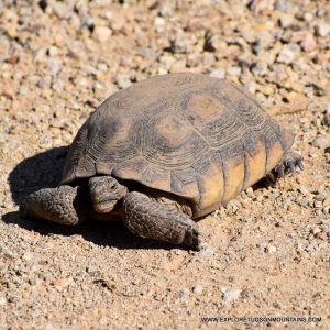
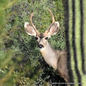
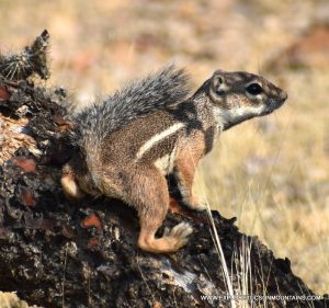
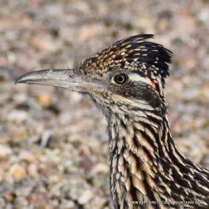
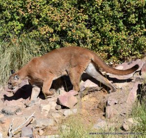
Tucson Mountain’s Wildlife and More Great Stuff!
Every visit offers a chance to spot something new—making the Tucson Mountains a true destination for wildlife discovery and unforgettable desert experiences.