
Find the Perfect Tucson Mountains Trail
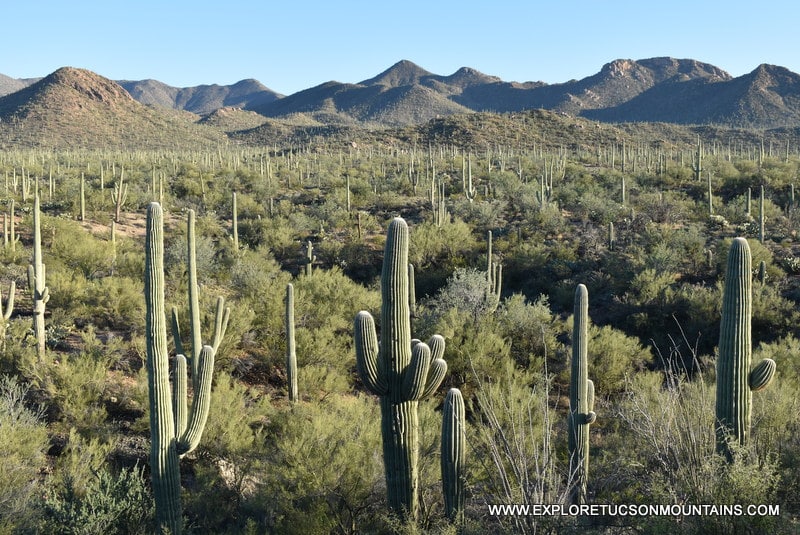
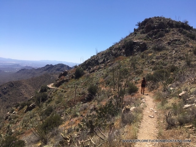
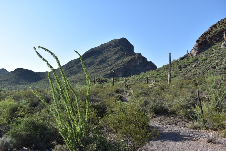
The Tucson Mountains offer some of Southern Arizona’s most scenic hiking experiences, with trails winding through towering saguaro forests, rugged desert peaks, historic sites, petroglyphs, and panoramic viewpoints. Whether you’re looking for a short family-friendly walk, an ADA-accessible trail, a dog-friendly route, or a challenging summit hike, you’ll find detailed information below.
Use the searchable trail directory to compare mileage, difficulty levels, elevation changes, and permitted activities. Each trail listing includes key details and links to additional trail information to help you plan your next Tucson Mountains adventure.
Best easy, intermediate and difficult trails. Best dog friendly trails. Best ADA trails. Elevation changes. Trail heads.
ABBREVIATION KEY
SNP – Saguaro National Park
PHT — Painted Hills Trails Park
GWP — Greasewood Park
TMP – Tucson Mountain Park
SWP — Sweetwater Preserve
SPP — Sentinel Peak Park
FPP — Feliz Paseo Park
E — Easy
I — Intermediate
D — Difficult
| TRAIL | LOCATION | MILES | LEVEL | ELEVATION | ELEV. CHANGE | HORSE | BIKE | DOG | ADA | NOTES |
|---|---|---|---|---|---|---|---|---|---|---|
| 360 Vista Trail | TMP | 1.12 | I | 2622 / 2831 | 209 | Y | Y | Y | N | Connector -- Sunset Pass to Camaro Loop |
| 36th Street Trail | TMP | 1.82 | E/I | 2611 / 2682 | 71 | Y | Y | N | N | Trailhead -- 36th St to Starr Pass Trail |
| A Mountain Backside Trail | SPP | 0.40 | I/D | 2478 / 2628 | 150 | N | N | N | N | Trailhead -- Starr Pass Rd to A Mountain |
| Abington Trail | SNP | 1.00 | E | 2422 / 2515 | 93 | N | N | N | N | Trailhead --Abington Rd to Thunderbird Trail |
| Bactrain Summit | PHT | .2 | I | 2648 / 2777 | 129 | Y | Y | Y | N | Summit off of Mosaic Trail |
| Bajada Wash | SNP | 1.60 | E | 2489 / 2721 | 32 | N | N | N | N | Trailhead -- Sus Picnic Area to Hohokam Rd |
| Belmont Trail | SNP | 0.70 | E | 2326 / 2345 | 19 | N | N | N | N | Trailhead -- Belmont Rd to N. Abington Rd |
| Bittersweet Trail | TMP | 2.00 | I | 2662 / 2747 | 85 | Y | Y | Y | N | Connector -- Jericho, Sunset to Camaro Loop |
| Black Rock Loop | SWP | 1.80 | E/I | 2522 / /2587 | 65 | Y | Y | Y | N | Trailhead -- Sweetwater Preserve to Saguaro Vista Trail |
| Bob Mora Trail | FPP | 0.39 | E | 2563 / 2591 | 28 | N | N | Y | Y | Feliz Paseo Park Interpretive ADA Trail |
| Boulder Belt Trail | TMP | 1.13 | D | 2572 / 2692 | 20 | Y | Y | Y | N | Connector -- Camaro Loop to Flight Path |
| Bowen Trail | TMP | 0.82 | I | 2751 / 2827 | 76 | Y | Y | N | N | Trailhead -- Starr Pass Resort to Yetman & Bowen Stone House Ruins |
| Brittlebrush Trail | SNP | 1.30 | E/I | 2539 / 2769 | 230 | N | N | N | N | Connector -- Thunderbird to Picture Rocks Wash |
| Brown Mtn Trail | TMP | 4.55 | I | 2660 / 3071 | 411 | Y | Y | N | N | Trailhead --McCain Loop M9 pullout |
| Cactus Canyon Trail | SNP | 0.90 | I | 2483 / 2626 | 143 | N | N | N | N | Connector -- Thunderbird & Gila Monster to Picture Rocks Wash |
| Cactus Garden Trail | SNP | 0.05 | E | 2521 / 2546 | 25 | N | N | N | Y | Saguaro National Park West Park Interpretive ADA Trail |
| Cactus Wren Trail | SNP | 1.50 | I | 2263 / 2470 | 207 | N | N | N | N | Trailhead --Signal Hill & Petroglyphs to Sandario Hill Rd |
| Caliche Flats Connector | TMP | 0.15 | E | 2515 / 2521 | 6 | Y | Y | N | N | Connector -- Caliche Flats and Avery Bryce |
| Caliche Flats Trail | TMP | 2.89 | E | 2430 / 2585 | 155 | Y | Y | N | N | Connector --Prospector to Ironwood & Creosote |
| Camaro DT | TMP | 0.45 | I | 2552 / 2594 | 42 | Y | Y | Y | N | Connector -- Across Camaro Loop |
| Camaro Loop Trail | TMP | 2.16 | E/I | 2553 / 2635 | 82 | Y | Y | Y | N | Loop -- Trailhead end of Irvington Place |
| Cam-Boh Trail | SNP | 2.70 | E/I | 2388 / 2540 | 152 | N | N | N | N | Trailhead - Cam-Boh Picnic Area, W Picture Rocks Rd |
| Campground Trail | TMP | 0.43 | E | 2592 / 2663 | 71 | Y | Y | N | N | Connector - Well Rd to Gates Pass Trail via Gilbert Ray Campground |
| Cascabel Cut Off | TMP | 0.22 | E | 2589 / /2643 | 54 | Y | Y | Y | N | Connector - Across Cascabel Loop |
| Cascabel Trail | TMP | 1.57 | E | 2579 / 2665 | 86 | Y | Y | Y | N | Loop -- Trailhead off West Irvington Rd |
| Chaparral Connector North | TMP | 0.17 | E | 2777 / 2801 | 24 | Y | Y | N | N | Connector -- Chaparral to Golden Gate. AKA Kerr Jar. |
| Chaparral Connector South | TMP | 0.36 | E | 2607 / 2645 | 38 | Y | Y | N | N | Connector -- Chaparral to Golden Gate Upper |
| Chaparral Trail | TMP | 0.53 | E | 2432 / 2773 | 341 | Y | Y | N | N | Trailhead -- Kinney Rd K11 pullout & Gates Pass G6 pullout. AKA Ironwood |
| Charlie's LoopTrail | FPP | 0.20 | E | 2594 / 2604 | 10 | N | N | Y | Y | Feliz Paseo Park Interpretive ADA Trail |
| Cheopes Trail | TMP | 0.28 | I | 2834 / 2984 | 150 | Y | Y | N | N | Trailhead -- Gates Pass Rd G4 pullout to Gates Pass Trail |
| Chico's Hay Trail | TMP | 0.38 | E/I | 2455 / 2562 | 107 | Y | Y | Y | N | Trailhead -- Mission Rd to Boulder Belt |
| Christine Molina Trail | FPP | 0.20 | E | 2592 / 2603 | 11 | N | N | Y | Y | Feliz Paseo Park Interpretive ADA Trail |
| Coatimundi Trail | TMP | 1.00 | I | 2551 / 2657 | 106 | Y | Y | N | N | Connector -- Gilbert Ray to Brown Mountain. AKA northern segment of Well Rd |
| Coyote Pass Trail | SNP | 0.90 | E | 2440 / 2568 | 128 | N | N | N | N | Connector -- Cactus Canyon, Gila Monster, Abington |
| Creosote Loop Trail | TMP | 0.55 | E | 2500 / 2528 | 28 | Y | Y | Y | N | Connector & Loop -- Irvington Rd, Rocky 13 |
| Crosstalk Trail | GWP | 0.40 | E | 2408 / 2453 | 45 | Y | Y | Y | n | Connector -- Mosaic Wash Loop to Speedball |
| Desert Discovery Trail | SNP | 0.50 | E | 2408 / 2425 | 16 | N | N | N | Y | Saguaro National Park West Interpretive ADA Trail |
| Desperado Loop | SWP | 3.60 | E/I | 2405 / 2564 | 159 | Y | Y | Y | N | Trailhead -- Sweetwater Preserve Trailhead |
| Dobe Wash | SNP | 1.40 | E/I | 2731 / 3125 | 394 | N | N | N | N | Trailhead -- Hohokam Rd. Connector to Sendero Esperanza |
| ECDH Climbing Trail | TMP | 0.40 | D | 2680 / 2839 | 159 | N | N | Y | N | Spur -- via Stone House |
| El Grupo Loop -Lower Trail | TMP | 2.00 | E | 2498 / 2630 | 132 | Y | Y | N | N | Trailhead -- 36th St. Part of El Grupo Loop. AKA Enchanted Hills Loop |
| El Grupo Loop - Upper Trail | TMP | 0.69 | I | 2605 / 2720 | 115 | Y | Y | N | N | Trailhead -- 36th St. Part of El Grupo Loop. AKA Enchanted Hills Loop |
| Enchanted Hill Peak | TMP | 0.20 | D | 2613 / 2747 | 134 | Y | Y | N | N | Enchanted Hills Peak via Around the Hill. |
| Enchanted Hills Connector | TMP | 1.00 | E/I | 2503 - 2536 | 33 | Y | Y | N | N | AKA Portal Trail. Connector -- Enchanted Hills Loop to Explorer |
| Encinas Trail | SNP | 3.60 | E/I | 2295 / 2956 | 661 | N | N | N | N | Trailhead -- Ez-Kim-In-Zin Picnic area to Sandario Rd |
| Escape to Ajo Trail | TMP | 0.57 | E | 2476 / 2640 | 144 | Y | Y | Y | N | Trailhead -- 36th St. Connecter to Boulder Belt |
| Explorer Trail | TMP | 2.50 | E/I | 2497 / 2715 | 218 | Y | Y | N | N | Trailhead -- W 44th St. to Cat Mtn. Trail |
| Fire 7 Trail | TMP | 0.40 | E | 2514 / 2563 | 49 | Y | Y | Y | N | Trailhead -- Shannon Rd. Connector to El Grupo Lower. AKA Shannon. |
| Flight Path Trail | TMP | 1.01 | I | 2565 / 2625 | 60 | Y | Y | Y | N | Loop -- via Boulder Belt |
| Flint Trail | TMP | 1.80 | E/I | 2752 / 2829 | 77 | Y | Y | N | N | Connector -- Starr Pass Trail. AKA Sarasota Trail |
| Frick Trail | TMP | 0.64 | E | 2513 / 2569 | 56 | N | Y | Y | N | Connector -- Greasewood Pipeline to West Via de Sueno Rd |
| Gates Pass Trail | TMP | 4.20 | E/I | 2457 / 3137 | 680 | Y | Y | N | N | Trailhead --Gates Pass Overlook to Prospector |
| Gila Monster Trail | SNP | 0.50 | E | 2453 / 2541 | 88 | N | N | N | N | Connector -- Thunderbird to Coyote Pass |
| Gilbert Escandon Jimenez Trail | SPP | 1.00 | I/D | 2508 / 2694 | 186 | N | N | N | N | Trailhead -- Sentinel Peak Dr. Connect to A Mountain Backside |
| Gilbert Ray Trail | TMP | 2.00 | E | 2466 / 2618 | 154 | Y | Y | N | N | Tailhead -- Kinney Rd K-14 to prospector. AKA as the western segment of Gates Pass trail. |
| Golden Gate Trail | TMP | 2.60 | I | 2606 / 3188 | 20 | Y | Y | N | N | Trailhead -- Kinney Rd K9 pullout to Yetman Trail |
| Gould Mine Trail | SNP | 1.10 | E/I | 2881 / 3154 | 273 | N | N | N | N | Trailhead -- King Canyon to Sendero Esperanza. Gould Mine ruins. |
| Hidden Canyon Trail | TMP | 1.52 | I | 2737 / 3087 | 350 | Y | Y | N | N | Trailhead - West Starr Pass Rd to Bowen Trail. AKA Lorraine Lee Hidden Canyon |
| High Noon Trail | TMP | 0.30 | E | 2514 / 2529 | 15 | Y | Y | N | N | AKA Middle child Trail. Connector Enchanted Hills Loop |
| Homestead Trail | SWP | 1.00 | E/I | 2622 / 2678 | 56 | Y | Y | Y | N | Connector -- Lost Arrow, The Spine, Ocotillo Trail, Red Tail Ridge |
| Hugh Norris Trail | SNP | 4.90 | I | 2573 / 4584 | 2011 | N | N | N | N | Trailhead -- Hugh Norris to Wasson Peak. Highest peak in Tucson Mtns. |
| Ironwood Connector | TMP | 0.45 | I | 2527 / 2571 | 44 | Y | Y | N | N | Connector - Ironwood Loop to Prospector. AKA - So. Segment of Caliche Flats |
| Ironwood Forest | SNP | 1.40 | E/I | 2419 / 2563 | 44 | N | N | N | N | Connector -- Cam-Boh to Picture Rocks Wash |
| Ironwood Loop | TMP | 7.00 | E | 2430 / 2630 | 200 | Y | Y | N | N | Loop -- Combining Avery Bryce, Kerr Jar, Ironwood & Creosote |
| Javelina Wash Trail | SNP | 0.20 | E | 2544 / 2562 | 18 | N | N | N | N | Interpretive Trail around Red Hills Vistor Center |
| Jericho Trail | TMP | 0.04 | E | 2694 / 2699 | 5 | Y | Y | Y | N | Trailhead -- W Lincoln St to Sunset Pass Trail |
| Kain Trail | TMP | 0.26 | I | 2715 / 2775 | 60 | Y | Y | N | N | Connector -- El Grupo Loop Upper and Wild West Trail. AKA Stone House trail. |
| King Canyon Trail | SNP | 3.50 | I | 2919 / 4588 | 1669 | N | N | N | N | Trailhead -- King Canyon to Wasson peak. Highest peak in Tucson Mtns. |
| Ledge Surfer Trail | TMP | 0.65 | I | 2556 / 2659 | 103 | Y | Y | Y | N | Trail Head -- Ajo Rd to Camaro Loop |
| Little Cat Trail | TMP | 1.00 | I | 2774 / 2833 | 59 | Y | Y | N | N | AKA Beer Garden Trail. Connector between Cat Mtn and Yetman |
| Lorraine Lee Hidden Canyon Trail | TMP | 1.52 | D | 2737 / 3087 | 350 | Y | Y | N | N | Trailhead -- West Starr Pass Rd to Bowen Trail. AKA Hidden Canyon. |
| Lost Arrow Trail | SWP | 0.60 | I | 2528 / 2657 | 129 | Y | Y | Y | N | Connector -- Saguaro Vista to The Spine |
| Manville Trail | SNP | 2.50 | E | 2278 / 2428 | 150 | N | N | N | N | Trailhead -- Signal Hill Picnic area to Cactus Wren and Encinas. |
| Mariposa Trail | TMP | 0.52 | I | 2581 / 2598 | 17 | Y | Y | N | N | Connector -- Gates Pass to Avery Bryce. |
| Middle Child Trail | TMP | 0.30 | E/I | 2514 / 2529 | 15 | Y | Y | N | N | Connector -- Enchanted Hills Loop. AKA High Noon Trail |
| Monsoon Loop | PHT | 1.0 | E | 2583 / 2694 | 111 | Y | Y | Y | N | Loop via Moasic Trail |
| Mosaic | PHT | 1.1 | E | 2577 / 2702 | 125 | Y | Y | Y | N | Trailhead -- Painted Hills Trailhead |
| Mosaic Wash Loop Trail | GWP | 2.10 | E/I | 2367 / 2456 | 89 | Y | Y | Y | N | Trailhead -- Greasewood Park |
| Mule Deer Trail | SNP | 0.30 | E/I | 2435 / 2442 | 7 | N | N | N | N | Connector -- Ironwood Forest and Ringtail |
| Night Hawk Trail | SWP | 0.40 | E/I | 2524 / 2550 | 26 | Y | Y | Y | N | Connector -- Desperado Loop, Oxbow, Red Tail Ridge |
| Northern Loop | TMP | 1.00 | D | 2529 / 2643 | 114 | Y | Y | Y | N | Loop -- via Painted Hills Trail. AKA Perimeter |
| Ocotillo Hill | SWP | 0.80 | E/I | 2580 / 2631 | 48 | Y | Y | Y | N | Connector -- Homestead, Red Tail Ridge, |
| Orcutt Trail | TMP | 2.60 | I | 2705 / 3226 | 521 | Y | Y | N | N | Trailhead -- Gates Pass G10 pullout. Ends in Saguaro National Park |
| Overlook Trail | GWP | 0.40 | E | 2441 / 2487 | 46 | Y | Y | Y | N | Trailhead -- Greasewood Park -- Connector to Orientation Course. |
| Oxbow Trail | SWP | 0.50 | E | 2551 / 2572 | 21 | Y | Y | Y | N | Connector -- Wildflower Ridge, Red Tail Ridge, Nighthawk |
| Pack Rat Trail | SNP | 0.40 | I | 2230 / 2356 | 126 | N | N | N | N | Coccector -- Scenic Trail to Passey Loop |
| Panther Peak Wash | SNP | 1.90 | E | 2349 / 2497 | 48 | N | N | N | N | Connector -- Roadrunner to Cam-Boh |
| Passey Loop Trail | SNP | 1.50 | E | 2200 / 2272 | 72 | N | N | N | N | Trailhead -- N. Iron Ridge Dr. |
| Peak View Trail | TMP | 0.70 | E | 2724 / 2873 | 149 | Y | Y | N | N | Connector -- Tucson Estates Trail and Yetman |
| Peter Axelson Trail | FPP | 0.10 | E | 2582 / 2593 | 9 | N | N | Y | Y | Feliz Paseo Park Interpretive ADA Trail |
| Picture Rocks Wash | SNP | 2.70 | E/I | 2414 / 2901 | 487 | N | N | N | N | Connector -- Prophecy Wash, Brittlebrush, Ironwood Forest, Coyote Pass |
| Portal Trail | TMP | 0.96 | E | 2503 / 2536 | 33 | Y | Y | Y | N | Connector -- El Grupo Loop to Explorer. AKA Enchanted Hills Explorer Connector |
| Prickly Pear Trail | TMP | 0.18 | E | 2779 / 2804 | 25 | Y | Y | N | N | Trailhead -- Gates Pass Rd G6 pullout. Connector -- Ironwood to Golden Gate |
| Prickly Poppy Trail | TMP | 2.00 | E | 2500 / 2625 | 20 | Y | Y | N | N | Connector -- Avery Bryce, Ironwood Loop, Prospector |
| Prophecy Wash Trail | SNP | 1.90 | E | 2530 / 2869 | 339 | N | N | N | N | Connector -- Cam-Boh to Picture Rocks Wash |
| Prospector Trail | TMP | 3.90 | I | 2436 / 2654 | 218 | Y | Y | N | N | Trailhead -- Kinney Rd K9 pullout to Well Road |
| Rattlesnake Trail | TMP | 0.30 | E | 2802 / 2813 | 11 | Y | Y | N | N | Trailhead - Gates Pass Rd G5 pullout. Connects Gates Pass to Golden Gate. |
| Recoil Peak | PHT | .2 | E | 2642 / 2695 | 53 | Y | Y | Y | N | Summit off or Monsoon Loop |
| Red Canyon Trail | SWP | 0.50 | I | 2633 / 2681 | 48 | Y | Y | Y | N | Connector -- Homestead Trail |
| Red Tail Ridge Trail | SWP | 1.00 | I | 2536 / 2633 | 97 | Y | Y | Y | N | Connector -- Night Hawk, Oxbow, Ocotillo Hill, Homestead |
| Rift Trail | TMP | 0.23 | E | 2555 / 2570 | 15 | Y | Y | Y | N | Connector -- El Grupo Lower |
| Ringtail Trail | TMP | 0.58 | I | 2688 / 2795 | 107 | Y | Y | N | N | Trailhead -- Kinney Rd K19 pullout. Connector -- Brown Mtn to Cougar |
| Ringtail Trail | SNP | 1.00 | E/I | 2394 / 2468 | 74 | N | N | N | N | Connector -- Cam-Boh to Picture Rocks Wash |
| Roadrunner Trail | SNP | 1.20 | E/I | 2350 / 2487 | 133 | N | N | N | N | Trailhead -- Cam-Boh Trail to Panther Peak Wash |
| Robles Loop | TMP | 13.0 | I/D | 2552 / 2888 | 336 | Y | Y | N | N | Trailhead - Richard E. Genser. Multiple trails through Robles Pass. |
| Robles Pass Trail | TMP | 1.2 | E/I | 2568 / 2765 | 197 | Y | Y | Y | N | Connector -- Cat Mtn/Explorer to Ledge Surfer |
| Rock Wren Trail | TMP | 2.1 | I | 2785 / 2891 | 106 | Y | Y | N | N | Connector -- Yetman to starr Pass Trails |
| Rocky 13 Trail | TMP | 0.60 | E | 2527 / 2648 | 121 | Y | Y | Y | N | Connector -- Camaro Loop to Creosote Loop |
| Roller Coaster Trail | SWP | 0.40 | E | 2473 / 2500 | 27 | Y | Y | Y | N | Trailhead -- Sweetwater Preserve Trailhead to Saguaro Vista |
| Safford Peak Trail | SNP | 1.40 | D | 2250 / 3541 | 1291 | N | N | N | N | Spur -- Via Scenic Trail to Safford Peak |
| Saguaro Rib Trail | TMP | 0.20 | E | 2713 / 2738 | 25 | Y | Y | N | N | Connector -- Yetman to Starr Pass Trails |
| Saguaro Vista Trail | SWP | 1.1 | E/I | 2468 / 2564 | 96 | Y | Y | Y | N | Trailhead -- Sweetwater Preserve Trailhead to Black Rock Loop |
| Santa Catalina Vista | PHT | .001 | E | 2578 / 2581 | 3 | Y | Y | Y | N | View from Mosaic Trail |
| Sarasota Trail | TMP | 2.00 | I | 2749 / 2872 | 123 | Y | Y | N | N | Connector to Starr Pass & Yetman. AKA Flint Trail |
| Scenic Trail | SNP | 0.70 | E/I | 2246 / 2346 | 100 | N | N | N | N | Trailhead -- End of Scenic Dr. to Safford Peak and Passey Loop. |
| Sego Trail | TMP | 0.21 | E | 2605 / 2609 | 4 | Y | Y | N | N | Connector -- Campground to Gates Pass Trail |
| Sendero Esperanza Trail | SNP | 3.20 | I | 2989 / 3604 | 615 | N | N | N | N | Trailhead -- Sendero Esperanza to Hugh Norris and King Canyon |
| Shannon Trail | TMP | 0.40 | I | 2516 / 2563 | 49 | Y | Y | Y | N | AKA Fire 7. Trailhead -- Shannon Rd. Connector to Enchanted Hills West. AKA Fire 7 |
| Shannon Access | TMP | 0.32 | E | 2552 / 2581 | 29 | Y | Y | N | N | Trailhead -- So Shannon Rd to El Grupo Loop |
| Shay Park Trail | FPP | 0.46 | E | 2578 / 2609 | 31 | N | N | Y | Y | Feliz Paseo Park Interpretive ADA Trail |
| Signal Hills Petroglyphs Trail | SNP | 0.50 | E | 2429 / 2461 | 32 | N | N | N | N | Trailhead -- Signal Hills Picnic Area to Petroglyphs and Cactus Wren Trail |
| Siphon Trail | TMP | 0.31 | E | 2703 / 2736 | 33 | Y | Y | N | N | Trailhead -- Gates Pass Rd G9 pullout to Orcutt Trail |
| Slingshot Trail | pht | 1.5 | I | 2532 / 2644 | 112 | Y | Y | Y | N | Trailhead -- Painted Hills, off Mosaic Trail |
| Speedball Trail | GWP | 0.30 | E/I | 2375 / 2429 | 54 | Y | Y | Y | N | Connector -- Mosaic Wash |
| Spine Trail | GWP | 0.60 | E | 2405 / 2458 | 54 | Y | Y | Y | N | Connector -- Pima County College Track to Mosaic Wash Loop |
| Starr Pass Main Loop | TMP | 9.30 | I | 2710 - 2917 | 207 | Y | Y | N | N | Trailhead - Richard E. Genser. Star Pass Trail to Yetman, Rock Wren |
| Star Pass Resort Access | TMP | 0.95 | I | 2703 / 2832 | 20 | Y | Y | N | N | Trailhead -- Richard E. Genser Trailhead to Rock Wren &Yetman |
| Starr Pass Trail | TMP | 4.80 | I | 2676 / 2878 | 202 | Y | Y | N | N | Trailhead -- Richard E. Genser Trailhead to Yetman |
| Straight Shot Trail | GWP | 0.40 | E | 2385 / 2418 | 33 | Y | Y | Y | N | Trailhead -- Greasewood Park to Mosaic Wash Loop |
| Sun Circle Loop | SWP | 0.60 | E/I | 2549 / 2599 | 50 | Y | Y | Y | N | Loop -- via Desert Vista |
| Sunset Pass Trail | TMP | 1.39 | I | 2631 / 2722 | 91 | Y | Y | Y | N | Trailhead -- W Lincoln Rd to 360 Vista |
| Sweetwater Trail | SNP | 3.40 | I | 2810 / 3866 | 1056 | N | N | N | N | Trailhead -- Sweetwater Trailhead to King Canyon, Thunderbird |
| Tecolote Trail | TMP | 0.51 | D | 2564 / 2602 | 38 | Y | Y | N | N | Loop -- off Fire 7 . AKA Around the Hill |
| The Spine | SWP | 0.60 | I | 2592 / 2669 | 77 | Y | Y | Y | N | Connector -- Homestead, Lost Arrow, Wildflower Ridge |
| Thunderbird Trail | SNP | 1.90 | I | 2546 / 2897 | 351 | N | N | N | N | Connector -- Sweetwater to Brittlebrush, Cactus Canyon and Gila Monster |
| Triple C Trail | TMP | 0.50 | E | 2497 / 2544 | 47 | Y | Y | N | N | Connector -- Well Rd to Avery Bryce |
| Tucson Estates Trail | TMP | 1.37 | E | 2639 / 2867 | 228 | Y | Y | N | N | Trailhead -- Kinney Rd K2 pullout to Yetman Trail |
| Tucson Mountain Park Loop | TMP | 10.60 | E | 2428 / 2882 | 454 | Y | Y | N | N | Trailhead - Gates Pass Rd G5 pullout to Golden Gate, Creosote & Gates Pass. |
| Tumamoc Hill Trail | SPP | 1.60 | I/D | 2367 / 3107 | 740 | N | N | N | N | Trailhead -- N Silverbell Rd to peak |
| Valley View Overlook Trail | SNP | 0.38 | I | 2645 / 2676 | 31 | N | N | N | N | Spur -- Wild Dog to Scenic View |
| Vertical Cliffs | SNP | 1.80 | E | 2330 / 2474 | 144 | N | N | N | N | Trailhead -- Belmont Road to Abington Trail |
| Veteran's South Trail | SNP | 0.40 | E | 2416 / 2436 | 20 | N | N | N | N | Connector -- Veritical Cliffs to Abington Trail |
| Wasson Peak Summit - Hugh Norris | SNP | 4.90 | I/D | 2574 / 4674 | 2000 | N | N | N | N | Trailhead -- Hugh Norris to Wasson Peak Trail |
| Wasson Peak Circle Loop | SNP | 8.40 | I/D | 2914 / 4674 | 1760 | N | N | N | N | Trailhead - King Canyon to Sendaro Esperanza to Hugh Norris to King Canyon |
| Wasson Peak Summit - Sweetwater | SNP | 4.70 | I | 2814 / 4674 | 1860 | N | N | N | N | Trailhead -- Sweetwater Trail to King Canyon to Wasson Peak Trail |
| Wasson Peak Trail | SNP | 0.30 | E | 4529 / 4678 | 149 | N | N | N | N | Spur -- Via High Norris or King Canyon to Wasson Peak |
| Well Road Trail | TMP | 2.90 | E | 2384 / 2594 | 210 | Y | Y | N | N | Trailhead -- So. San Joaquin Rd to Brown Mtn. AKA Northern segment referred to as Coatimundi on some maps. |
| Western Loop | TMP | 0.98 | I | 2575 / 2691 | 116 | Y | Y | Y | N | Loop -- End of Painted Hills Trail. |
| Wild Dog Trail | SNP | 1.00 | E/I | 2511 / 2682 | 171 | N | N | N | N | Trailhead -- Hohokam Rd to Golden Gate Rd |
| Wild West Trail | TMP | 0.49 | D | 2671 / 2840 | 169 | Y | Y | N | N | Connector -- Kain Trail to El Grupo Lower. AKA Stone House Trail |
| Wildflower Ridge Trail | SWP | 0.70 | I | 2467 / 2589 | 122 | Y | Y | Y | N | Connector -- Desperado Loop, Roller Coaster, The Spine, Oxbow |
| Yetman Trail | TMP | 6.24 | I | 2689 / 3145 | 456 | Y | Y | N | N | Trailhead -- Camino De Oeste Trailhead to Gates Pass Rd G3 pullout. |


MORE GREAT STUFF