Tucson Petroglyphs: Discover Ancient Rock Art in the Tucson Mountains
Step back in time and explore some of Southern Arizona’s most fascinating archaeological treasures. Hidden among the saguaros and rugged desert landscapes of the Tucson Mountains, ancient petroglyphs and pictographs reveal stories left behind by the Hohokam people more than a thousand years ago. Discover the area’s most accessible rock art sites, hiking information, and tips for respectful visitation.
Where to See Petroglyphs and Pictographs in the Tucson Mountains
The Tucson Mountains are home to some of Arizona’s most remarkable examples of prehistoric rock art. Archaeological sites throughout the region preserve petroglyphs carved into stone and pictographs painted on rock surfaces by Indigenous peoples, including the Hohokam, whose presence in the area dates back many centuries. Today, visitors can experience these cultural treasures while exploring scenic desert landscapes filled with towering saguaros and panoramic mountain views.
Several sites offer opportunities to view rock art, ranging from easy walks to more adventurous hikes. Signal Hill in Saguaro National Park West is the most popular and accessible location, featuring dozens of visible petroglyphs along a short trail. The Redemptorist Renewal Center contains one of the largest collections of glyphs in the area, while Kings Canyon Trail provides a rewarding hike past ancient carvings and historic Civilian Conservation Corps structures. Adventurous hikers can also seek out the Black Sheep Pictograph Cave, home to one of the Tucson area’s most significant prehistoric painted rock art sites.
These sites are irreplaceable cultural resources. Visitors should remain on designated trails, avoid climbing on rock formations, and never touch petroglyphs or pictographs, as even skin oils can damage these fragile works of art. By exploring responsibly, future generations will continue to learn from and appreciate these extraordinary connections to Southern Arizona’s past.
SIGNAL HILL
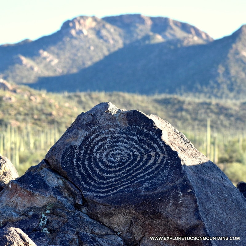
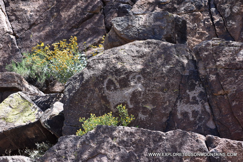
Signal Hill petroglyphs site is located in the Saguaro National Park West. There are dozens of images viewable from a short trail and viewing area. Look at the images up to the left as you start to climb the trail, they are commonly missed.
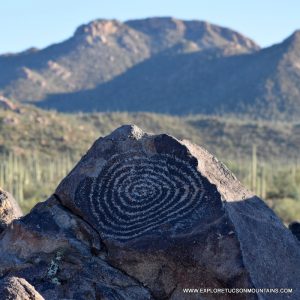
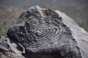
A large spiral image, a favorite among photographers, is at the viewing area on top of the hill. The panoramic view of Wasson Peak and Sombrero Peak over an incredibly dense Saguaro forest is incredible.
Directions from the park’s Red Hills Visitor Center: Turn right onto Kinney Rd. Go 1.8 miles onto N. Sandario Rd. Go .3 miles and turn right onto Golden Gate Rd. Go 1.5 miles and turn left onto Signal Hill Rd. The Signal Hill Trailhead is at the picnic area. The hike to the petroglyphs is only .4 mile roundtrip.
Climbing on the rocks is not permitted. Please stay on the trail and viewing area. Please note . . . Golden Gate Road is closed at sunset.
SIGNAL HILL PETROGLYPHS SITE Signal Hill Rd Tucson, AZ 85743
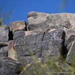
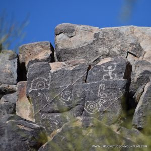
Redemptorist Renewal Center site is located on private property owned by the Redemptorist Renewal Center. It is estimated there are between 800 and 1,000 individual glyphs on the hill. Please check-in at the Center office or call 520-744-3400 before visiting.
Directions from Interstate-10: Take Ina Rd west 2.5 miles, then turn left (south) onto Wade Road. After about a half-mile, Wade Road curves to the right (west) and becomes Picture Rocks Road. The Redemptorist Renewal Center is on the left-hand side.
Follow the paved driveway past the retreat’s building complex, and park where the lower driveway turns north past the buildings. The Picture Rocks petroglyph site is on the small hill immediately west of the building complex. Most of the petroglyphs are on the west and east sides of the hill.
Climbing on rocks is not permitted. Please stay on the trail around the east and south sides of the hill. Proceed down the brick stairway into the wash below the hill, where you will find the best view of the glyphs along the hill’s west side.
REDEMPTORIST RENEWAL CENTER 7101 W Picture Rocks Rd Tucson, AZ 85743
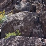
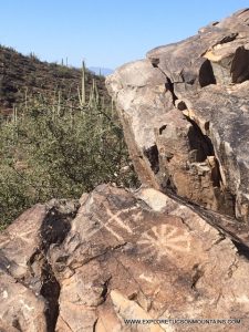
Kings Canyon Trail site is located within the Saguaro National Park West. There are dozens of images, but the site is not marked and can be easily missed. An added benefit is that there is also an old stone building built by the Civilian Conservation Corps in the early 1930s near the site.
Directions from the Park’s Red Hills Visitor Center — The trailhead is 2 miles east from the Visitor Center directly across from the AZ-Sonoran Desert Museum.
Take the trail as it gradually climbs following an old mining road once used to access the Mile Wide Mine. The petroglyphs are .9 mile up the trail on either side of a wide wash just before a small damn and the Mam-AGah Picnic Area.
Please do not touch the petroglyphs. Even the oil from your hand can harm the image.
KINGS CANYON TRAIL SITE Kinney Rd Tucson, AZ 85743
Follow an old mining road to view Tucson Petroglyphs.
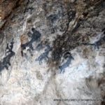
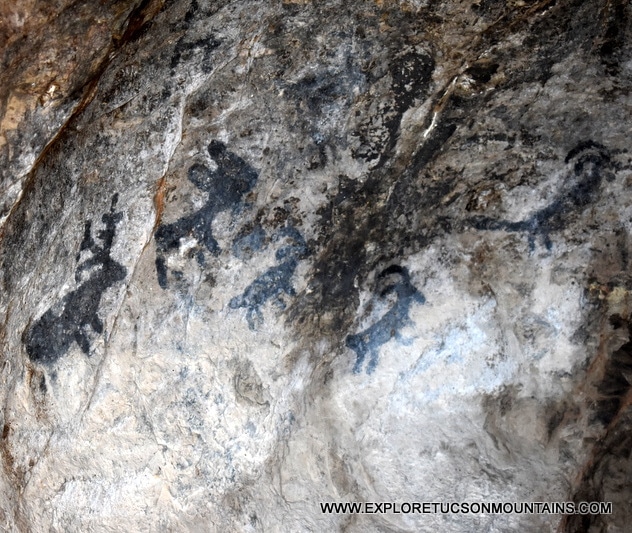
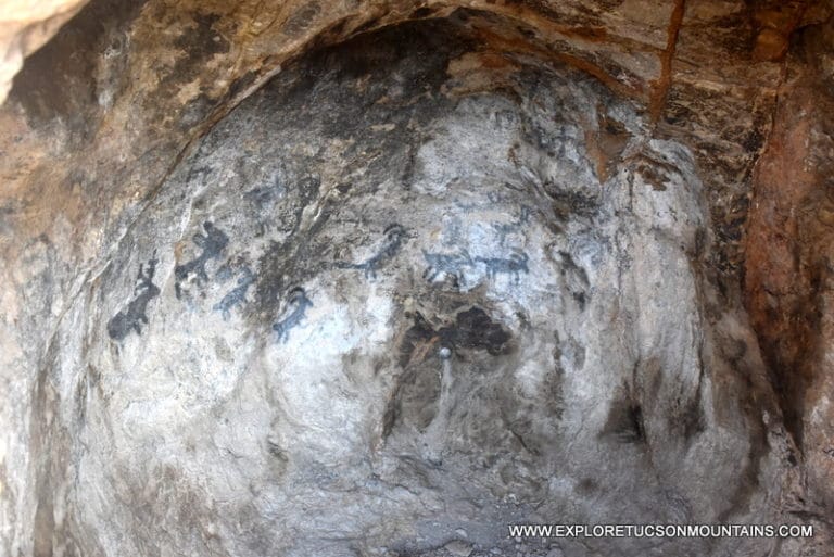
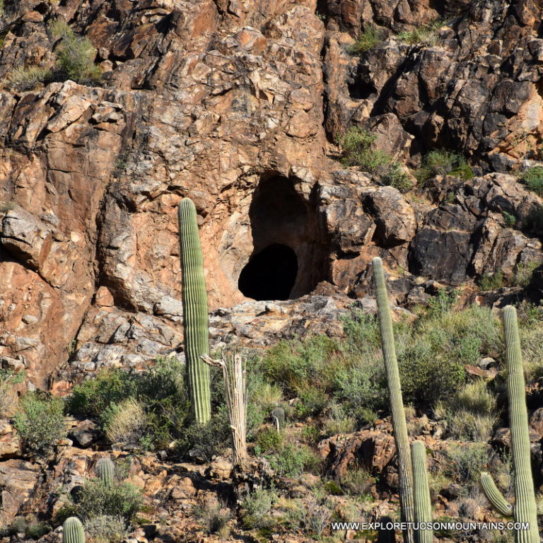
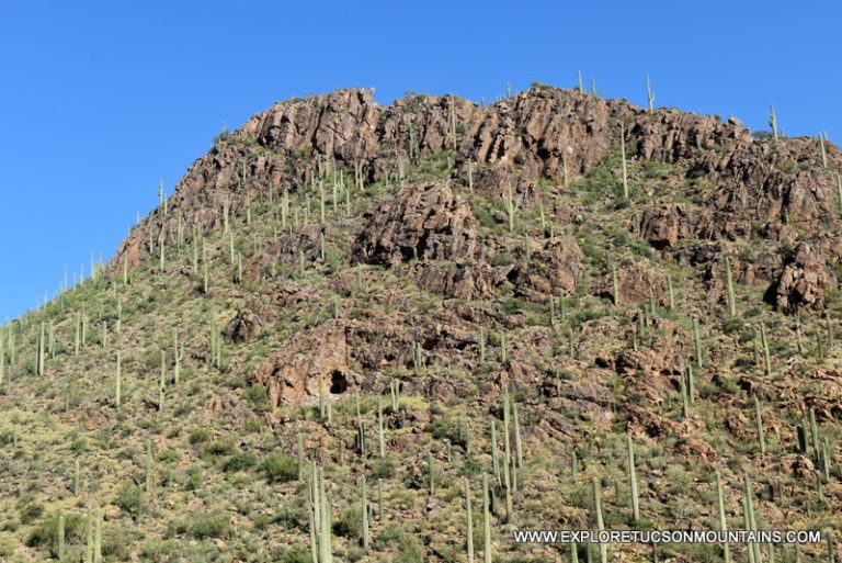
BLACK SHEEP PICTOGRAPH CAVE PAINTING
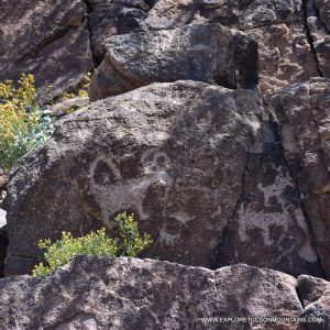
The Black Sheep Pictograph is the most elaborate prehistoric pictograph site known in the Tucson area. It is believed an ancient Hohokam artist left the drawings. The paintings are of horned animals that roamed the area and were most likely hunted by the Hohokams.
Finding the cave paintings is somewhat tricky. Take the Yetman Trail from the Camino de Oeste Trailhead about 1/2 mile past the Bowen Stone House. There is an unmarked trail leading to the west.
The trail is marked by cairns and “whispering saguaros”. Two saguaros that look like they are whispering to one another. Take the unmarked trail about 1/2 mile and keep your eyes on the rock ledges to your right as you climb. You will notice the cave tucked into the side of the hill across a rocky ravine. Be careful; the rocky ground can be tricky.
Please do not touch the pictographs. Even the oil from your hand can harm the images.
TUCSON MOUNTAIN PARK Tucson Mountain Range
Camino De Oeste Trailhead 415 N Camino de Oeste Tucson, AZ 85745
The trailhead is at the end of Camino De Oeste Road and provides access to the Yetman Trail. The Yetman trail will go directly to and past the Stone House and to an unmarked trail leading past the cave paintings.
Tucson Mountain’s Wildlife and More Great Stuff!
Every visit offers a chance to spot something new—making the Tucson Mountains a true destination for wildlife discovery and unforgettable desert experiences.