
Tucson Mountains Abandoned Mines: History and Hiking Guide
Explore the Abandoned Mines of the Tucson Mountains
The Tucson Mountains are home to a rich but often overlooked mining history. Formed from an ancient volcanic system, the region’s geology created veins of copper, silver, and gold that attracted prospectors as early as the late 1600s. By the late 1800s, the area became part of the Amole Mining District, one of the earliest recorded mining regions in North America. Hundreds of claims were established, and the mountains were actively explored for valuable minerals during the late 19th and early 20th centuries.
Today, remnants of these operations are scattered throughout the landscape. Across the Tucson Mountains, there are more than 200 abandoned mines, prospects, and mining pits, many hidden along hiking trails or among desert vegetation. Some of the most well-known sites include the Old Yuma Mine, Gould Mine, Mile Wide Mine, and Gila Monster Mine. These locations reveal traces of mining life, such as tailings piles, foundations, and fenced shafts, offering a tangible connection to the region’s past.
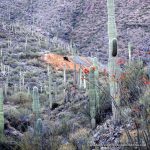
For hikers and history enthusiasts alike, the Tucson Mountains provide a rare opportunity to combine scenic desert views with a deeper understanding of Arizona’s mining heritage. Many modern trails follow historic mining roads, allowing visitors to retrace the paths once used by miners searching for fortune in the Sonoran Desert.
While these abandoned mines add intrigue to outdoor exploration, it’s important to remember they can be dangerous. Open shafts, unstable structures, and hidden hazards are common, so visitors should always stay on marked trails and avoid entering mine openings.
Featured Abandoned Mines in the Tucson Mountains
OLD YUMA MINE
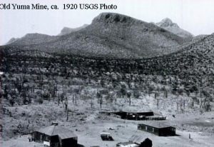
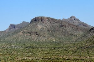
Old Yuma Mine was the most successful mine in the Tucson Mountains. The original claim dates back to 1872, and it was the last mine in the area to close in 1947. Copper, silver, gold, and other commodities were mined from this location.
During War World I, Molybdenum (used for hardening steel) was mined, and the owners added a mill and smelter, which ran until 1920. Attempts to reopen the mine in the 1980s failed because of legal battles, and Saguaro National Park acquired the property in 2001.
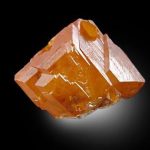
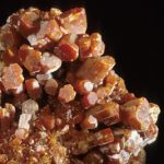
The mine is better know for its museum-quality, orange-red wulfenite crystals and an exciting kidnapping that occurred in the early 1930s.
In 1932 Cliff Adkins kidnapped Tucson banker Gordon Sawyer for a $60,000 ransom. The local deputies were able to track the abductor and rescue Mr.Sawyer from an abandoned well at a local ranch. However, Adkins escaped and hid at the Old Yuma Mine, forcing the owner, “One-Eyed” Joe Baker, to feed him. Mine caretakers reported Atkins to authorities, and the Tucson Police and Border Patrol eventually apprehended the kidnapper.
- COMMODITIES: Copper, Silver, Gold, Molybdenum, Lead, Zinc
- NUMBER OF SHAFTS: 1
- DEPTH OF SHAFTS: 300 feet
- PRODUCTION PERIOD: 1872, 1916 – 1947
- PRODUCTION: 5,700 tons
OLD YUMA MINE
LATITUDE & LONGITUDE:
32.31472, -111.12111
Start at the Picture Rocks Wash Trailhead located on W. Picture Rocks Rd. Hike 1.4 miles south to the intersection of Ringtail Trail. Move off trail to the southeast for .5 mile to the mine. Round trip 3.8 miles.
GILA MONSTER MINE
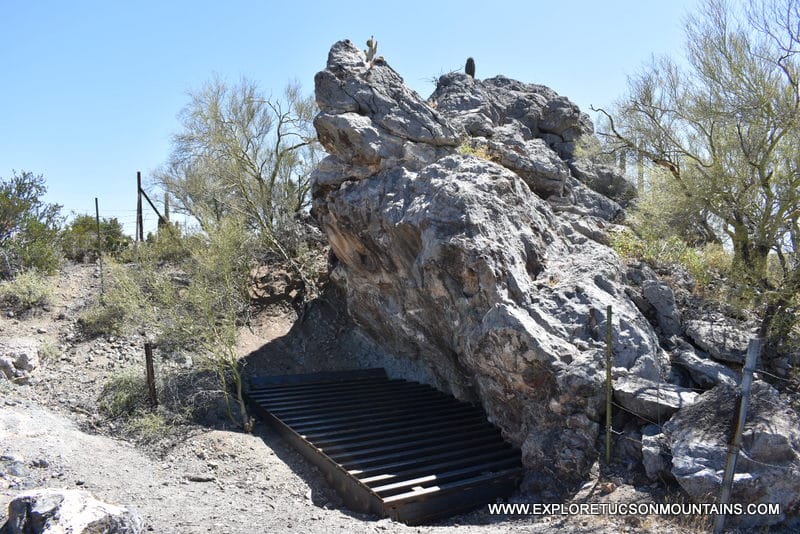
The Gila Monster Mine is located about one and a half miles south of the Old Yuma Mine. Not much is known about the origins of the mine. It was developed on a vein of lead, zinc, and copper mineralization adjacent to a large block of limestone. Production was minor, but impressive specimens of red-fluorescing calcite and willemite, a zinc silicate, were taken from the mine.
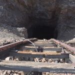
The mine shaft is at the foot of the large limestone boulder. The mine tailings are still prominent.
- COMMODITIES: Copper, Lead, Zinc
- NUMBER OF SHAFTS: 2 at 10 meters apart
- DEPTH OF SHAFTS: Unknown
- PRODUCTION PERIOD: Unknown
- PRODUCTION: Unknown
GILA MONSTER MINE
LATITUDE & LONGITUDE:
32.29611, -111.12056
Start at the El Camino Del Cerro Trailhead located at the west end of Camino Del Cerro Rd. Hike .2 miles and turn right onto the Thunderbird Trail. The trail will pass the Thunderbird Mine and descend 200 feet into a valley. The mine is on the right before the trail intersects with the Cactus Canyon Trail. Round trip 2.4 miles.
GOULD MINE
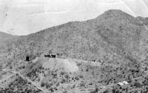
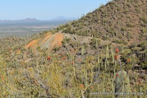
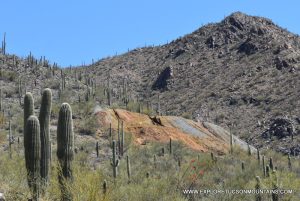
The Gould Mine was established in 1906 by S.H. Gould. He sensationalized the findings indicating the mine contained a mother lode of copper. It did produce 45,000 pounds of copper, valued at $9,000 at that time, but after several years the company went bankrupt and ceased operations in 1911.
During the 1950s, attempts were made to reopen the mine as an open-pit operation, but local opposition prevailed, and the property eventually became part of Saguaro National Park. It is currently classed as an archaeological site by the National Register
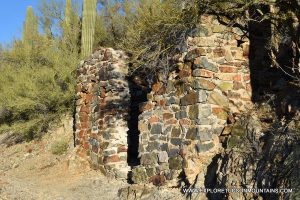
The pit is covered by an iron grate, and the powder house walls still stand. Foundations for the blacksmith shop and mess hall also remain. Samples of azurite, epidote, garnet, malachite, and pyrite, possibly originating form the mine tailings, can be found along the Sendero Esperanza Trail. The mine tailings can be seen from Kinney Rd north of the AZ-Sonoran Desert Museum.
- COMMODITIES: Copper, Silver, Lead
- NUMBER OF SHAFTS: 1
- DEPTH OF SHAFTS: 350 feet
- PRODUCTION PERIOD: 1907 – 1911, 1940
- PRODUCTION: 1,500 tons
GOULD MINE
LATITUDE & LONGITUDE:
32.25806, -111.16528
Start at the Gould Mine Trailhead located across the street from the AZ-Sonora Desert Museum. Follow the trail 1.1 miles in a northerly direction to the mine site. Watch for trailhead signs . . . the King Canyon Trailhead starts near the same location. Round trip 2.2 miles.
MILE WIDE MINE (ORIGINALLY COPPER KING MINE)

The Mile Wide Mine was initially named the Copper King Mine. When George Reininger purchased the mine from the original owner, L. Martin Warer, in 1915, the name was changed to Mile Wide because that was the width of the entire claim.
Reininger invested in the mine building a workshop, mess house, rock crusher, and mill. He also developed an access road into the mountains, which is now part of the King Canyon Trail system. The Mile Wide mine extracted 70,000 pounds of copper and silver; however, Reininger sensationalized his findings to investors. In 1919 he disappeared with the investors’ money along with $100,000 from selling his shares of stock. Several other owners worked the mine until it closed permanently in 1942.
The mine is now located within the Saguaro National Park. There is no trail to the mine site, but it can be reached by using the original mining roads, which are now overgrown and somewhat hard to follow.
- COMMODITIES: Copper, Silver, Gold, Molybdenum, Zinc, Lead
- NUMBER OF SHAFTS: 1
- DEPTH OF SHAFTS: 400 feet
- PRODUCTION PERIOD: 1914-1920, 1943
- PRODUCTION: 34,000 tons
MILE WIDE MINE
LATITUDE & LONGITUDE:
32.2633, – 111.15560
Start at the King Canyon Trailhead across the street from Az-Sonoran Desert Museum. Take the trail .9 of a mile to the Sendero Esperanza Trail intersection. Head north on the old mining road for .6 miles to the mine. The mining road is overgrown and can be hard to follow. Round trip 3 miles.
THUNDERBIRD MINE
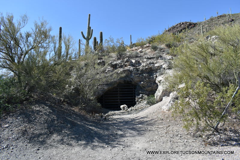
The Thunderbird Mine is the smallest of the mines listed here and is not much larger than a pospector’s hole. It is easily accessed of the Thunderbird Trail and a short walk from the Camino De Oeste Trailhead. It resembles a small cave and there are several other prospector’s diggings to the east of the mine along with an overgrown mining road that might have led to the Gila Monster Mine.
It is commonly mis-labeled in hiking guides and YouTube videos as the Gila Monster Mine which is actually a little further down the trail. There is not much information available on who owned the Thunderbird Mine and when it was in operation.
- COMMODITIES: Copper, Silver, Zinc, Lead
- NUMBER OF SHAFTS: 1
- DEPTH OF SHAFTS: Shallow
- PRODUCTION PERIOD: Unknown
- PRODUCTION: Unknown
THUNDERBIRD MINE
LATITUDE & LONGITUDE:
32.2917, -111.12500
Start at the El Camino Del Cerro Trailhead located at the west end of Camino Del Cerro Rd. Hike .2 miles and turn right onto the Thunderbird Trail. The mine is on the left about a quarter mile up the trail just before the trail drops down into a valley. The mine looks like a small cave and is fenced off. Round trip 1.5 miles.
Tucson Mountains Wildlife and More Great Stuff!
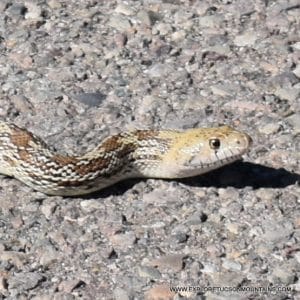
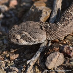
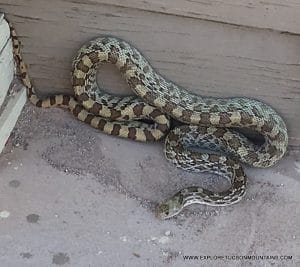
Every visit offers a chance to spot something new — making the Tucson Mountains a true destinationfor wildlife discoveryand unforgettable desert experiences.

MORE GREAT STUFF